 |
| Jolie and I did a 7 day backpack trip to the north wall in the Bob Marshall Wilderness. We had great weather, no smoke, and completed our longest backpack together (65 miles). Here we are on the first day (the only bad weather morning of the trip) heading up our first 2,000 foot high pass of the trip. |
 |
| Pretty waterfall below Headquarters Creek Pass |
 |
| 100 feet below Headquarters Creek Pass. |
 |
| On the other side of headquarters creek pass (far right side of picture). Comming down from the pass was only really strong wind we experienced during the whole trip. |
 |
| A major score on our first day - found a patch of huge strawberries (huge for wild strawberries) - tasted good on our chocolate dinner dessert. |
 |
| Bridge over North Fork Sun River - read the sign. Telephone polls in the wilderness?? It evidently wasnt that wild before it got designated a wilderness |
 |
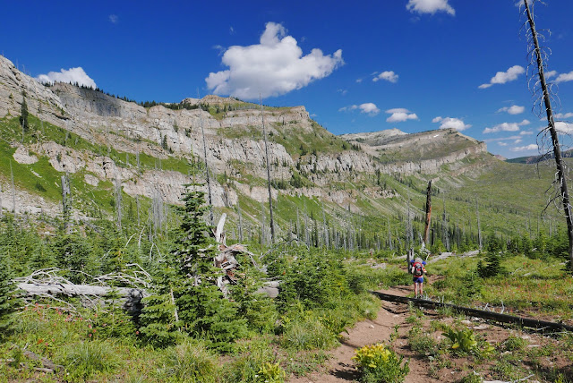
| No telephone polls here, or trees. One of the burn areas we hiked through. This is along Red Shale Ck. Good thing about burn areas is you can see for miles ... on a hot day the bad thing is no shade. |
 |
| Didnt see the black bear that made these prints |
 |
| Sunrise on the north wall near our second camp. |
 |
| Hiking along the north wall on day 3 on our way to Lake Levale, our 3rd straight day10 mile+ day with 2,000+ feet of elevation gain |
 |
| More views of the north wall |
 |
| more north scenery |
 |
| We saw thousands of gentian flowers during the week. |
 |
| Lake Levale, our destination on day 3. We spent two nights here to have time to explore and rest up. |
 |
| After lunch and a nap, we couldnt muster the energy to stand up for a selfie, so here is relaxed selfie (day 4) |
 |
| Jolie trying to avoid the hassle of taking boots off to cross a stream and instead balancing on shallow rocks. |
 |
| It was a pretty camp, but it was in the bottom of the valley and it was a very calm and clear night. We woke to 28 degrees. That is ice on our boots from the dew on the grass freezing on our boots. |
 |
| Day 7, first thing we had to do was take off our boots and cross that freezing cold creek before we warmed up and headed to Route Creek Pass. |
 |
| As we were just about to crest Route Creek Pass, Lonesome Ridge on the other side just looked so huge (it was) - made for a good picture showing the scale of the landscape |


No comments:
Post a Comment